3D Mark Viewer
3DSpecial marks
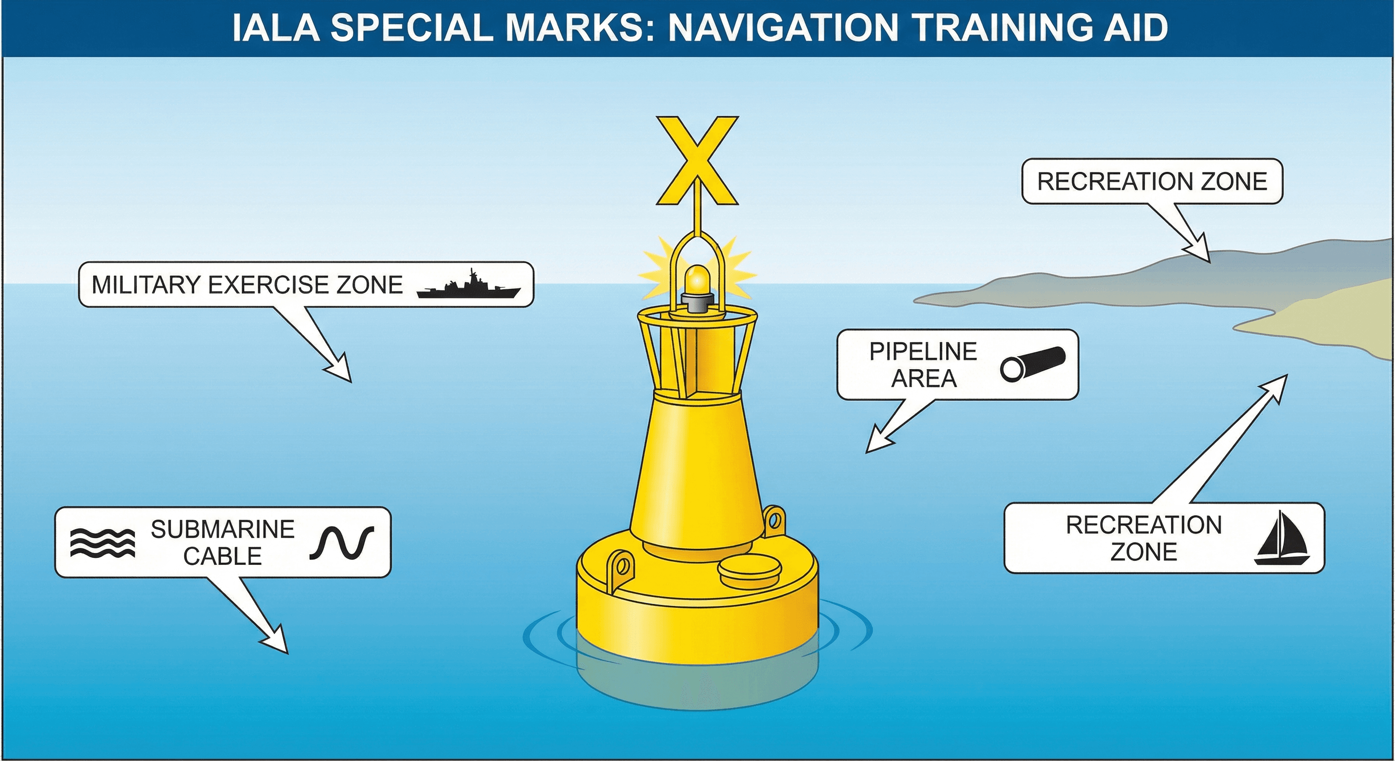
Special marks are yellow and denote areas or features referred to in nautical publications — they indicate a special purpose, not a navigational hazard.
Detailed Explanation
Special marks indicate an area or feature mentioned in nautical documents:
- Colour: yellow
- Shape: optional (any shape not conflicting with lateral/cardinal marks)
- Topmark: single yellow 'X' shape
- Light: yellow, any rhythm not used by other mark types
Uses include:
- Ocean Data Acquisition Systems (ODAS)
- Traffic separation marking (where conventional buoyage is not used)
- Spoil ground marks
- Military exercise zone boundaries
- Cable or pipeline marks
- Recreation zone boundaries
Important: a special mark does NOT indicate a navigational hazard. Its purpose is described on the chart and in associated publications. However, the area may have restrictions (e.g., anchoring prohibited over cables).
Key Points
- All yellow: colour, light (when fitted), and 'X' topmark
- Marks special areas — not primarily for navigation
- Check chart legend for the specific purpose
- Examples: pipelines, exercise zones, cables, spoil grounds
Examples
- You see a yellow pillar buoy with a yellow X topmark near a charted submarine cable area. This is a special mark per IALA, indicating a feature mentioned on the chart — in this case a cable crossing zone that requires no anchoring.
- At night you observe a yellow light with a rhythm distinct from cardinal patterns. The chart confirms a military exercise area boundary. Special marks are yellow throughout and their purpose is explained by chart legend.
Common Mistakes
- Assuming a yellow special mark indicates a navigational hazard when it actually denotes a special area like a pipeline or exercise zone.
- Confusing a special mark's yellow 'X' topmark with a cardinal topmark and attempting to navigate by cardinal logic.
- Ignoring special marks entirely because they are 'not navigation marks', when they may indicate areas with underwater cables or restricted zones.