3D Mark Viewer
3DSafe water marks
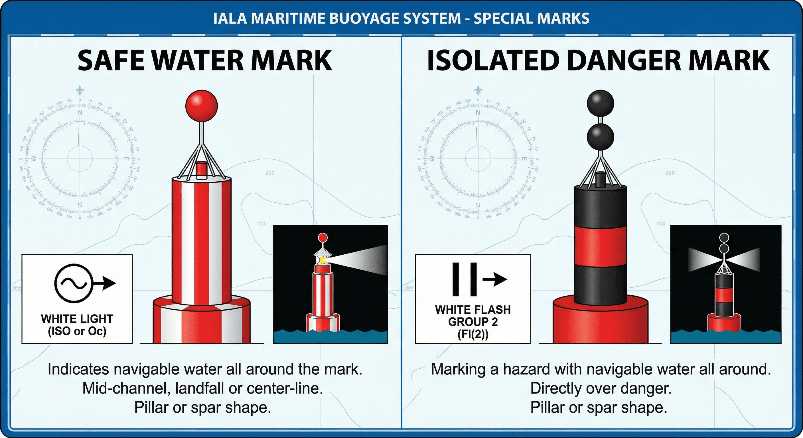
Safe water marks indicate navigable water all around — there is no danger. They are used as landfall marks, mid-channel marks, or fairway centreline buoys.
Detailed Explanation
Safe water marks show that there is navigable water all around them:
- Colour: red and white vertical stripes
- Shape: spherical (buoy), pillar, or spar
- Topmark: single red sphere
- Light: white, with one of these rhythms — Isophase (Iso), Occulting (Oc), Long Flash (LFl 10s), or Morse Code 'A' (·—)
They are typically placed at:
- Landfall points (first mark when approaching from sea)
- Mid-channel or fairway centreline positions
- The beginning of a buoyed channel
Key distinction: vertical stripes = safe water; horizontal bands on a different mark type indicate a different meaning (e.g., isolated danger or lateral preferred channel).
Key Points
- Red-white vertical stripes = navigable water all around
- Topmark: single red sphere
- Light: white Morse 'A' (dot-dash) or Iso or Oc or LFl 10s
- Used as landfall, mid-channel, or fairway centreline mark
Examples
- Making landfall after an ocean crossing, you see a red-and-white vertically striped spherical buoy with a single red sphere topmark. This is a safe water mark indicating navigable water all around — often used as a fairway or landfall buoy.
- At night you observe a white light showing Morse 'A' (short-long). This is the characteristic rhythm of a safe water mark, confirming you are approaching the centre of the navigable channel.
Common Mistakes
- Treating a safe-water mark as a lateral mark and keeping it strictly to one side instead of recognizing it indicates navigable water all around.
- Confusing red-and-white vertical stripes (safe water) with red-and-white horizontal bands (which do not exist in IALA).
- Not recognizing Morse 'A' (short-long) as the distinctive light characteristic of a safe-water mark.